Current Advisory & Key Details
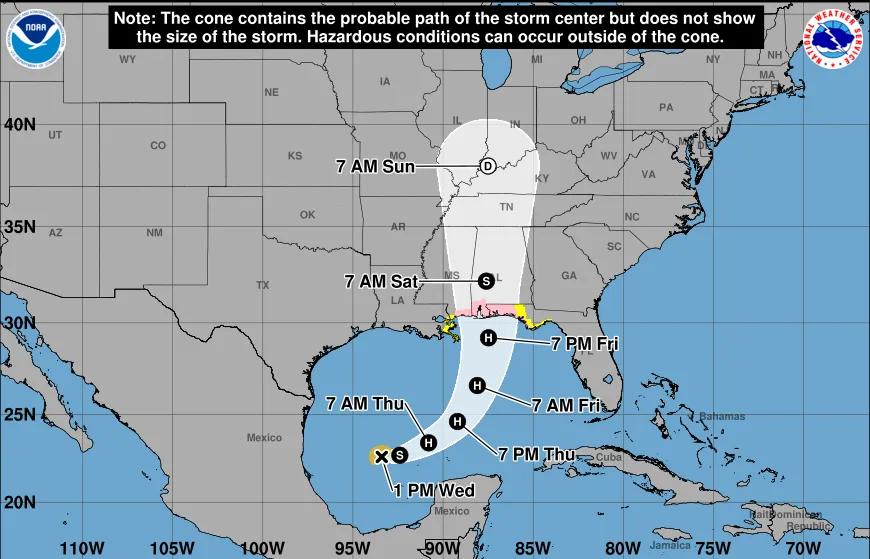
- Intensity Forecast: Isaias is expected to reach hurricane strength by Thursday and could approach Category 2 or Major Category 3 status before nearing the U.S. Gulf Coast.
- Projected Track: Moving east-northeast in the western Gulf, the storm is slated to turn northeast and north toward the northern U.S. Gulf Coast, with potential landfall targeted between late Friday and early Saturday.
- Watches & Warnings: Hurricane and Storm Surge Watches have been issued for portions of the northern Gulf Coast (stretching across regions from Louisiana through the Florida Panhandle).
Primary Risks Along the Coast
- Storm Surge: High surge risk along low-lying coastal areas from Louisiana to Northwest Florida.
- Heavy Rainfall & Flooding: Severe localized flash flooding and urban runoff, compounded by already saturated soils in parts of the Southeast.
- Wind & Rip Currents: Tropical-storm-force winds expanding outward, alongside dangerous, life-threatening surf and rip currents arriving ahead of the storm.
(Visited 27 times, 27 visits today)