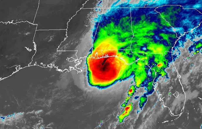
Summary of Current Landfall Details
Hurricane Isaias officially made landfall near Destin, Florida, around 8:30 PM CDT (9:30 PM EDT) on Friday, October 9, 2026.
- Intensity at Landfall: Category 2 Hurricane
- Maximum Sustained Winds: $105\text{ mph}$ ($165\text{ km/h}$)
- Key Observations:
- Santa Rosa Sound: Sustained winds of $91\text{ mph}$ with gusts up to $116\text{ mph}$.
- Pensacola: Wind gusts recorded over $100\text{ mph}$.
- Panama City Beach: Storm surge inundation gauge recorded levels around $5.4\text{ to }5.6\text{ feet}$ above normal tide level.
Ongoing Safety Hazards & Immediate Warnings
- Dangerous Wind & Tornado Risk: The National Weather Service (NWS) warns that danger does not cease after landfall. Embedded tornadoes and localized destructive gusts remain a major threat across the Florida Panhandle and southern Alabama/Georgia overnight.
- Life-Threatening Storm Surge: Inundation risks persist along low-lying coastal areas and bays east of the landfall center.
- Power Outages & Inland Flooding: Widespread power outages have impacted hundreds of thousands of customers in Florida and Alabama, with heavy rain squalls moving rapidly inland.
NWS Safety Advisory: Residents across the western Panhandle and surrounding inland zones should remain in their interior safe rooms and stay sheltered away from windows until all warning advisories are officially cleared.
(Visited 3 times, 1 visits today)